Session
Representing mountain regions. Images and maps to influence the territories
Cité des Territoires - Université Grenoble-Alpes
Du 11/01/2017 au 13/01/2017

Ever since humans have cast their eyes upwards at them, mountains have not only been described, but also represented by different types of still and moving images. Carvings, paintings, photography, paper maps, 3D maps, cartoons and films (home movies or television) have all projected both the reality and the representations of their authors. Some images were produced for discovery purposes through the eyes of an elite of tourists, mountaineers or travellers on territories captured in contradicting ways: magnificent landscapes and the veneration of their own exploits, or lamentation of the transformations of territories and societies considered at odds with modernity. Maps, especially those created by – and for – Alpine troops, served the dual purpose of knowledge and control. Conversely, other more recent images focus on the enhancement and marketing of these spaces, seen as places of innovation both in terms of their practices (sport, tourism) and their uses (protected spaces, new living spaces).
Whether real or fictional, the purpose of all these images is to account for a reality using processes that are usually the most recent in their sphere of production. They respond to a whole host of divergent or complementary needs, in particular security, development and valorisation.
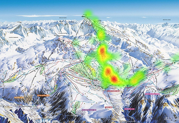
For example, as early as the 18th century, the military devised and represented the concept of altitude, reproduced on the first maps, which were also a means of identifying peaks even before they had been conquered. Two centuries later, with the rapid development of ski resorts, maps of ski slopes offered another form of representation, this time adapted to new mountain pursuits and in response to demands from those responsible for the ski areas. Regarded as an innovative technique for representing sporting and mountaineering exploits, photography was also used to underscore the value of mountain territories in view of their promotion, but also to support development decision-making.
Clearly, today's widespread use of new means of representation has brought about an increasingly confusing abundance of media supports and information, whether it be paper maps or websites, 3D smartphone apps or real-time billboards, GIS systems or big data flows. This situation raises a number of issues for operators concerning which information they want to pass on to their users (tourists, first-aid personnel, land developers, etc.) for specific purposes. However, this proliferation also changes users' perceptions of mountain regions, and the messages that operators want to send out or even sell.
This session has a twofold objective: an analysis of the processes adopted over the course of time to represent the realities of the mountain terrain via images and maps (in their broadest sense), and an analysis of the productions themselves selected to represent mountain territories. These two methodological and thematic aspects will be explored to attempt to understand how and by whom these representations are produced, used or even exploited, and with what consequences to the "operation" of mountain territories.
It will be interesting to confront the methods and choices made by different mountain ranges, whether it be the Alps with their multi-national dimension, the Pyrenees, or other massifs, in terms of what they choose to show and for what uses, with what expectations and what effects.

 Facebook
 Forward
 Google+
 LinkedIn
 Twitter


